Controller Pack Updates
Firstly, an apology
Following user feedback, I'd like to explain some recent functionality changes to the UK Controller Pack. My apologies for not ensuring that communication was widespread or detailed enough to keep disruption to a minimum. Going forward, we'll utilize UKCP notifications alongside regular procedure change posts and Discord announcements to better disseminate information to controllers.
Over the past four years, we've worked on moving the UK Controller Pack to GitHub, allowing us to collaborate much like we do with the sector file. This has been an ongoing and never-ending project with countless contributors whom I can't thank individually here. Their dedication to the upkeep of this resource and their wealth of real-world knowledge have culminated in, if I may say so, the most complete and realistic rendition of the real-world ATM systems (within the limitations of EuroScope) used across the UK that we've ever had.
Unlike some famed developers, I am not a master sculptor. I remember a time when all you got was a VRC sector file, and the rest you had to set up yourself. On that note, any member is welcome to submit suggestions, or those with the know-how can make changes directly on the GitHub repository. EuroScope by its nature is very customizable, but that also means members who prefer certain displays for ease of use make changes themselves. The aim of the UK Controller Pack is to strike a balance between replicating real-world systems to provide immersion to our controllers, while not making life difficult. I can't promise that we'll include a pink-colored SMR (looking at you, @Reece Buckley, @Kye Taylor, @Fergus Walsh), because that's not the aim of the pack. However, if you have changes that you need to make every time you update, please raise an issue on GitHub, as someone else may also be making the same changes every 28 days. Others have made suggestions on Discord to the ops team, and in turn, we've raised the issues on GitHub for action. I can't stress enough: it's a collaborative project, and your suggestions are most welcome.
Now to the recent changes that have caused some confusion. In 2020, at the request of some of our area controllers, we added the TopSky plugin to the area profiles. TopSky is a system by Thales that is used across many real-world ACCs. While it isn't the system used in the UK, much like EuroScope, the plugin allows extensive customization, so it can be made to mimic almost anything. EuroScope, as you are well aware, is getting rather old, and we've reached the limit of what it can do alone. Combining EuroScope and the TopSky plugin allows not only customization but also a whole host of features not available in "vanilla" EuroScope.
Fast forward to 2024. The features used by the area controllers are well embedded in their controlling (think CPDLC, medium-term conflict detection, etc.). For controllers moving from S3 to C1, this constitutes a big change in technology and interaction with datablocks. To somewhat address this, we added TopSky to the approach profiles to remove that jump and aid familiarization early on. It must be noted, though, that at this time, all of the tag/list-based interactions on approach profiles remain unchanged, with plans to move these over at a later date. So, below we'd like to explain some of the features TopSky brings, alongside some of the other improvements that have been made. I invite you to watch the original video that was made when we introduced TopSky in enroute, as I know some of you may already be bored from my drivel.
Automated Display Elements
Previously using "vanilla" EuroScope, controllers would have to select display elements based on runway configuration, time of day etc. TopSky now can now display elements such as RMAs, buffer zones, conditional airspace based on time of day, runway configuration, your controller position and whether other positions are online. An example below, but there are many.
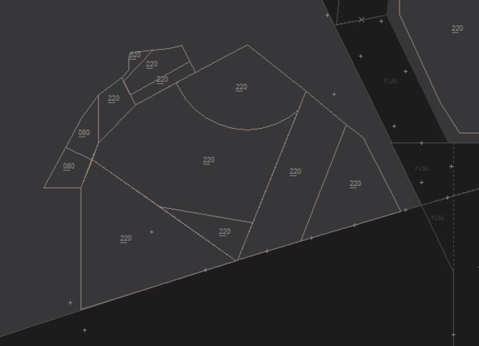
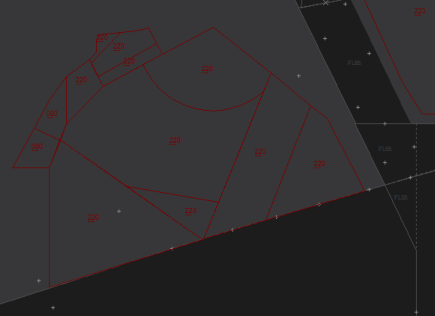
Berry Head CTA2/4 becomes active on evenings and weekends. During weekdays, this airspace conflicts with the Portsmouth danger area complex and therefore, reverts to Class G. Based on this TopSky will automatically draw the airspace to allow controllers to provide the correct service to aircraft. Whilst this shows an enroute style display, this is applied across all radar profiles.
Evenings/weekends vs. Weekdays
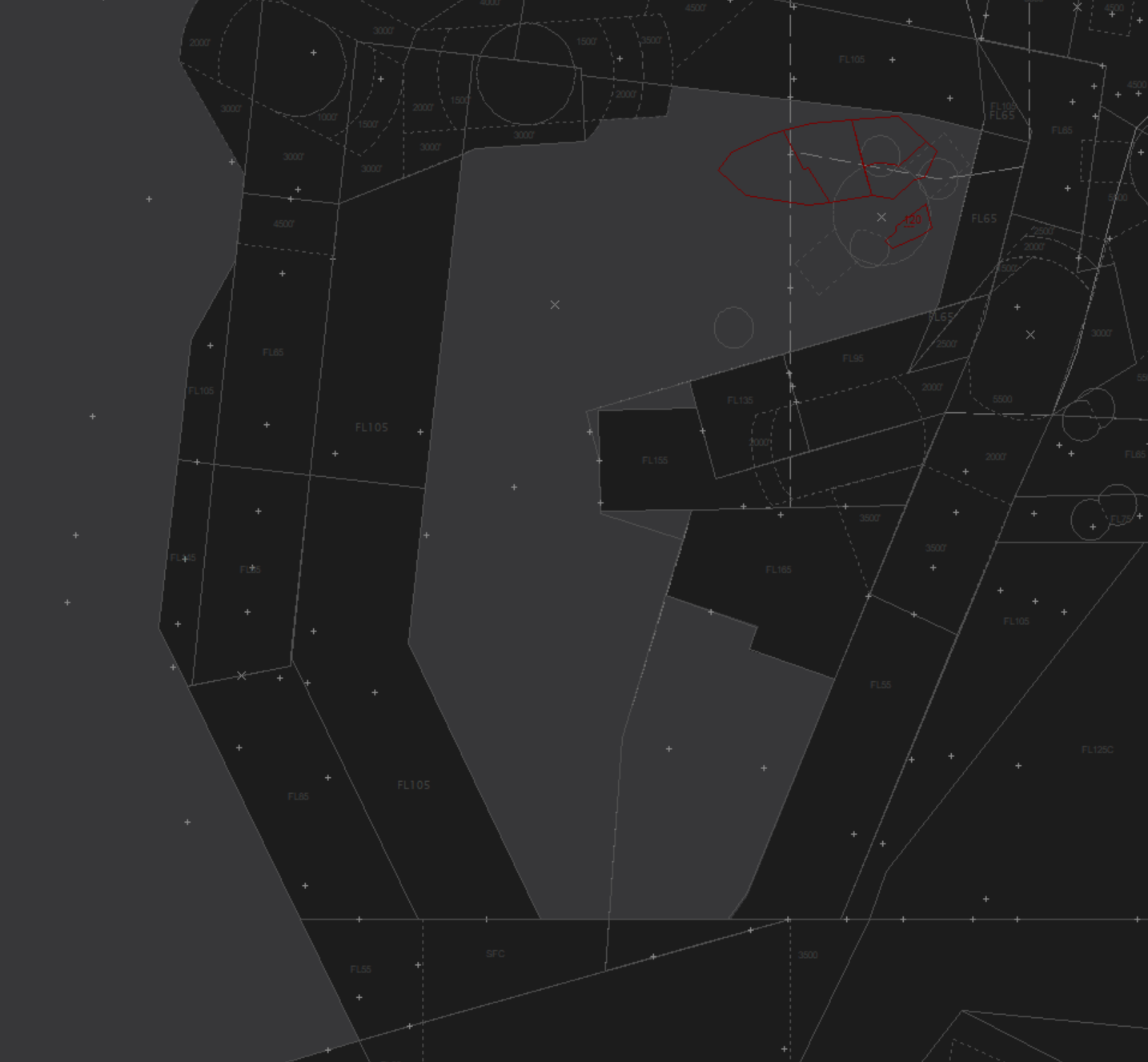
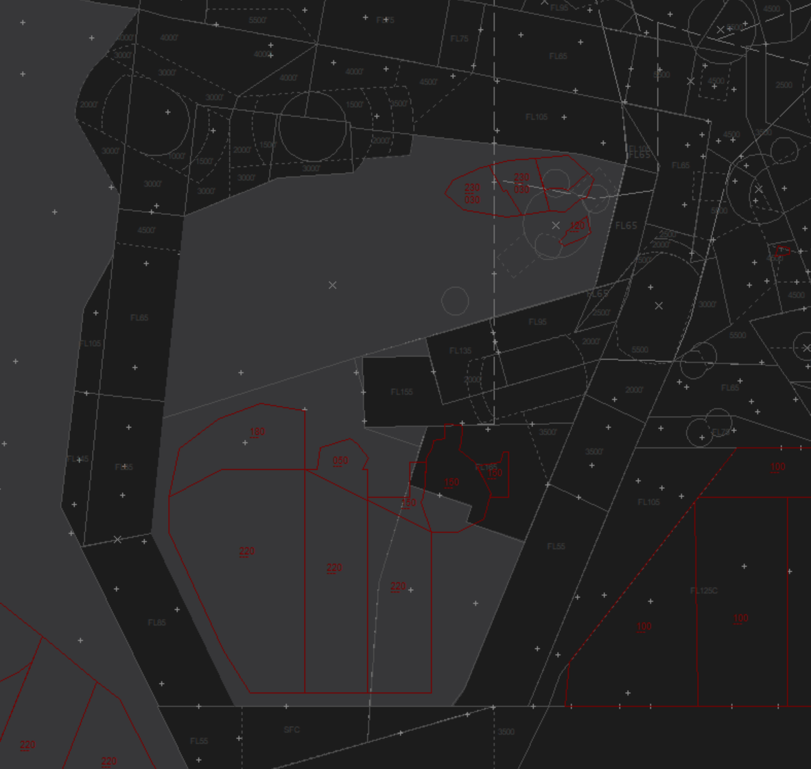
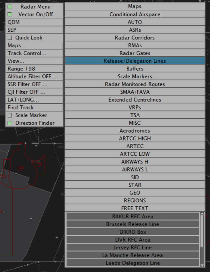
In a similar vein, when a user selects the runway configuration, TopSky will automatically redraw any runway dependent elements, such as the Heathrow or Manchester RMAs or extended centrelines. This all happens automatically. Users can manually enable/disable elements manually by utilising the TopSky "radar menu" by Alt + Right click -> Maps. To enable you left click, to disable, you right click.

When you first load up a profile, TopSky hasn't a clue where you intend to control, what runways are in use or which way is up. When you log into a position, all the relevant elements will be displayed. There is now no need to go into Display settings before logging in. Once you set your primary frequency the plugin will determine what information to show you.
Separation Tools
Some of these features may be superfluous at an approach level, but again, the aim is to introduce the same interface to controllers so it doesn't come as a surprise when trying to get a C1. These can certainly be useful to those training for their S3 as it will aid your "radar monitored" separation.
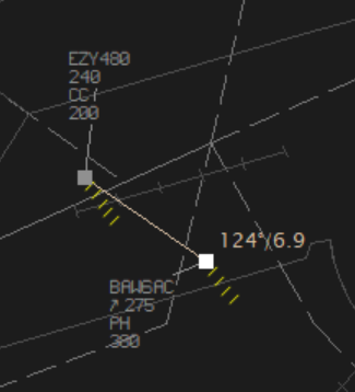
The SEP tool can be invoked by using the radar menu (Alt+Right click) and pressing SEP, alternatively by using Alt+S and clicking both returns. Shown below is the horizontal separation tool, which can also be configured to show the point of minimum vertical separation, by clicking the blue box. As you can see it shows the calculated minimum separation and how many minutes away from reaching the closest point of approach.
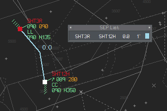
The QDM tool can be invoked by using the radar menu (Alt+Right click) and pressing QDM, alternatively by using Alt+Q and clicking both returns. This provides the distance between two returns. This may be helpful to monitor miles in trail when streaming.
Special Use Airspace
Everyday Eurocontrol publishes the airspace use plan (AUP), this defines which temporary segregated areas are active within Europe. TopSky can interpret this and dynamically displays danger areas & military training areas based on the real-world activation. Of course, you are welcome to ignore these as we have relatively low utilisation of special use airspace on the network, alongside Simbrief giving out weekend only routes during the week. These areas will show as white 10 minutes before coming active and red once active. However, if aircraft are calculated to enter one of the danger areas, you will begin to see an APW warning on the datablock, more on that further down.
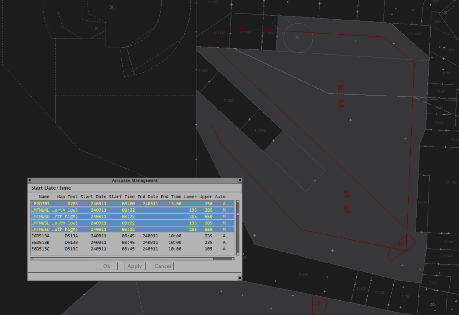
When the vRAF do come out to play, you can also manually activate these areas using the airspace management window, accessed by clicking AMS -> TSA in the TopSky Toolbar.
Safety Nets
You'll see on the approach profiles we've also added some extra safety nets, that aren't available in default EuroScope. They'll appear dynamically.
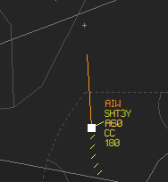
AIW - Airspace Infringement Warning
This highlights an aircraft within your sector that you have not assumed. To ignore the warning, simply click the AIW to ignore it.
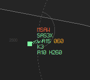
MSAW - Minimum Safe Altitude Warning
Displayed when an aircraft is below the minimum safe altitude for its' present position. This one took a long time for myself & @Mike Pike to get right. It's inhibited for aircraft on final approach, or intital departure from an airfield. Simply if you have this warning, you should consider telling the pilot to climb. For those interested, you can see the floor for this by going to STS -> Plugin Status -> MSAW -> View
APW - Area Proximity Warning
This is displayed when an aircraft is calculated, or already in a temporary segregated area. If you have some fast jets having a laugh, you can tell TopSky you don't care about this by using the HOLD/Susp menu.
CLAM/RAM - Cleared level adherence Monitor/Route Adherence Monitor
These were already in default ES, you may now see them abbreviated to L or R.

EuroScope Globe Projection
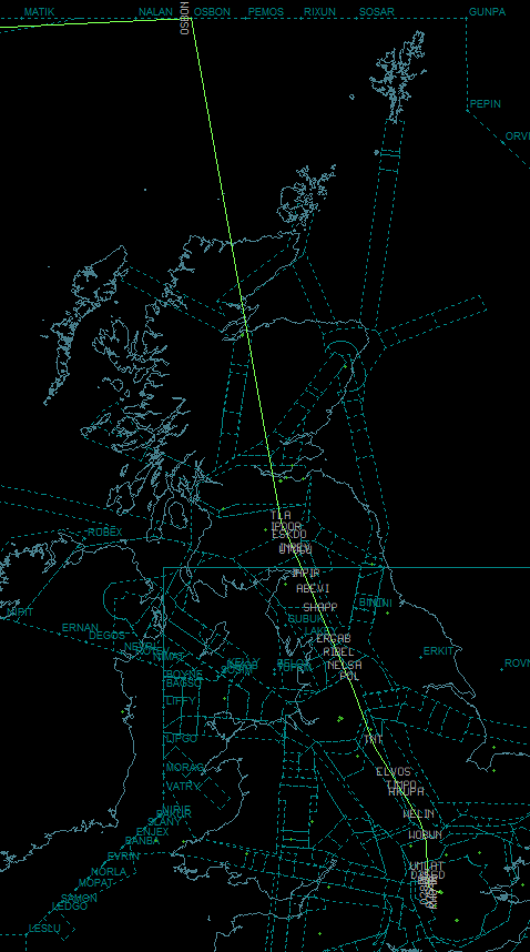
Not sure if anyone has actually noticed this one yet, as it's rather slight, but once you see it, you can't unsee it. As our sector file covers the entirety of the UK, it suffers from EuroScopes' projection method. In short, EuroScope considers the earth to be flat. To tackle the issues with this the sector file format defines a lat/lon to base its' projection off of. For us, that's around the DTY VOR. However, when controlling further north or south, this makes the projection incorrect. TopSky will look at which airfield you are controlling at and recenter the projection accordingly. To see the difference I'm on about, load up the Edinburgh.prf and use the ES command line ".dcenter EGPH". It'll now look a bit less squashed.
Pre-Tactical Tools
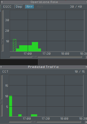
TopSky has some nifty tools that allow you to see when you're about to get raided. These can be accessed using STS -> Supervisory. You can see the predicated ops rate for a specific airfield, alongside predicted traffic for a sector. Red = Bad
There are lots of other little features I've not covered, but you are welcome to have a play with:
- Range Rings (Setup->RR Main)
- Radio Direction Finder (Setup->RDF)
- Conflict and Risk Display (CARD) (Tools->CARD)
- Vertical Aid Window (Tools->Vertical Aid Window)
- Weather Radar (Setup -> Weather Map)
non-TopSky based Improvements
Heathrow & Gatwick controllers will have already seen the benefit provided by the new version of vSMR (thanks @Alice Ford) The details of this have been explained in the ATC Notices Forum
With VFPC being included in the controller pack by request of the membership, this has also bought about a reliance on the plugin. As all S1s are taught, the VFPC plugin is there to be used as a guide, alongside your knowledge and the UKCP SRD search function. To aid controllers providing clearances, in all SMR profiles, we now include a route checking display. (Note, if you are controlling GND/DEL, it is assumed you are using the *SMR.prf as intended). This allows you to check the filed route of an aircraft if in an any doubt of its' validity. Simply use F1+2 to switch from the SMR display. You can then right click the callsign of the subject aircraft in the list, which will draw the route of the aircraft. You can then switch back to the SMR view by using F1+1.
Further Improvements
We're looking to make further refinements to the implementation to aid ease of use. For example, for area controllers covering top down, using a keyboard shortcut (such as Alt+V) we will display all VRPs to help when trying to get that pesky VFR aircraft into the zone. Unfortunately though it's a long process and with limited contributors, these things take time. Again, everyone is welcome to contribute, but I can appreciate that knowledge of the inner workings of EuroScope has diminished since we provide a complete pack.
Intended Use of Profiles
A final note on the different profiles and their intended purpose.
SMR Profiles
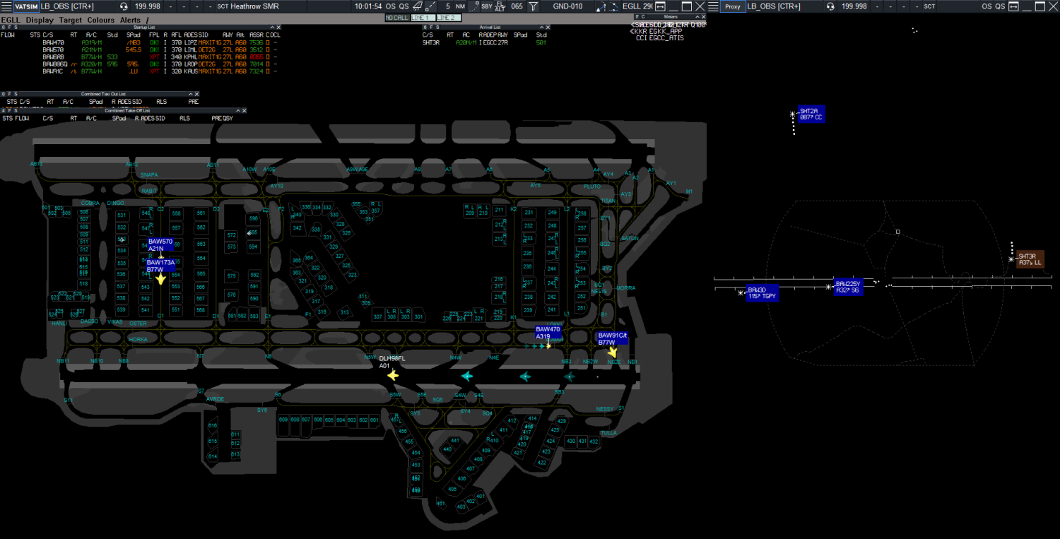
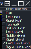
These are setup to provide a display akin to what is in use at large aerodromes IRL. Unless you go through the lengths to setup a tower view, this is the main way you will control at aerodrome level. If you are controlling DEL/GND/TWR, this should be the main profile that you use. Where available, I would also suggest using the ATM display for situational awareness. You can by right clicking the maximise window apportion each EuroScope instance to part of the screen. To create a picture such as below, or if you have two or more screens, have it on another screen. Do note, some smaller airfields do not have a dedicated SMR profile, and you'll have to use the associated "radar" profile.
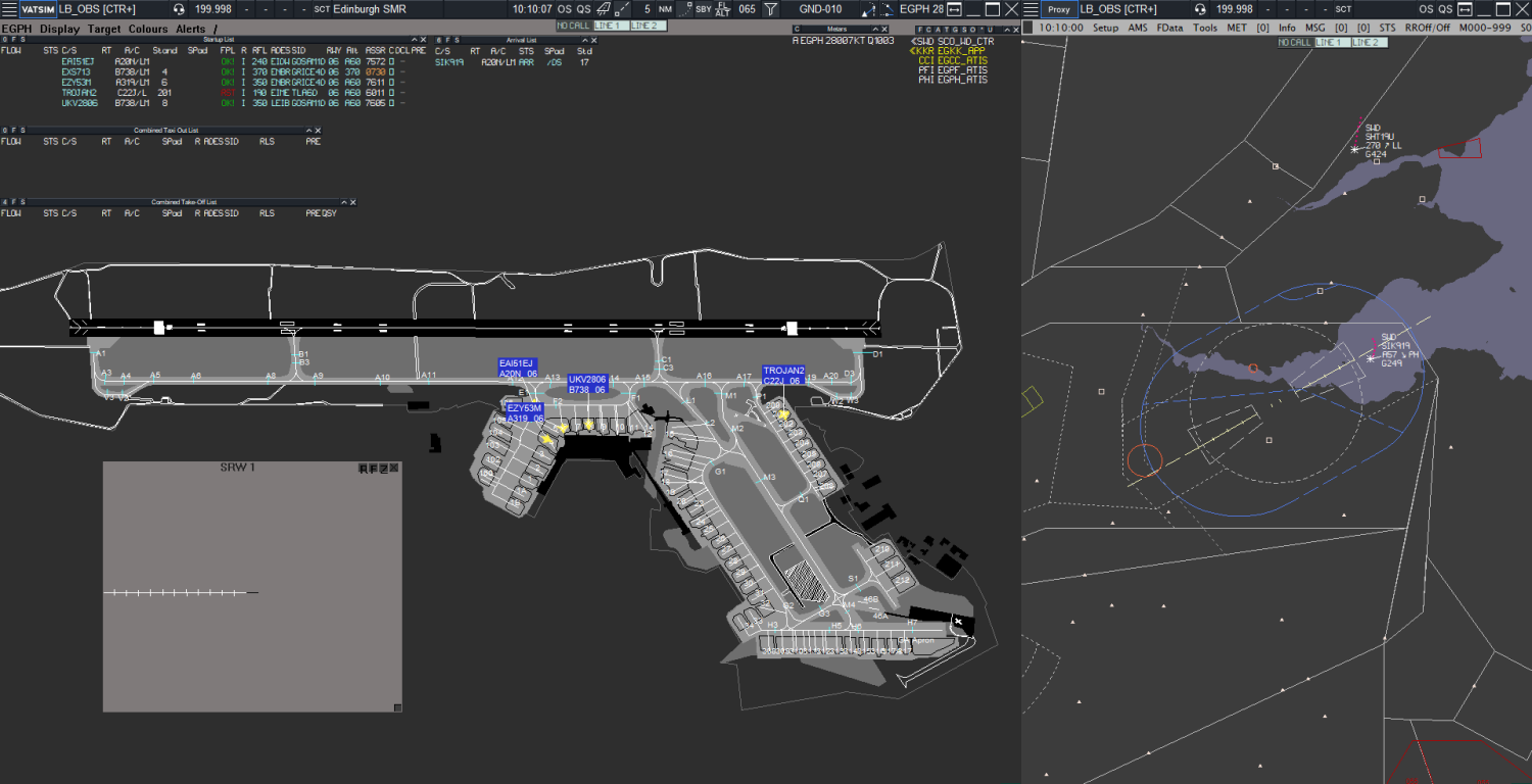
Of course, if you are in training and like to understand what's going on above the airfield, you can open a further instance of EuroScope and use it to familiarise yourself with the radar display used by APC/ENR controllers. This would also be the case in places such as Edinburgh, where no ATM exists. You can load the radar profile as a second instance, as below.
If you are unfamiliar with how to run two instances of EuroScope, the details are on the EuroScope wiki
If you've made it this far, I applaud you. Once we get around to adding the TopSky menus to other tag families, I'll do another randazzo-esque post such as this to highlight even more features that TopSky brings to the fold and how this will change how you interact with EuroScope. If any of our C1/C3s have any other features they like in TopSky, please feel free to share them with other members below so they can also benefit from the tools we have at our disposal.
Cheers,
Luke


0 Comments
Recommended Comments
There are no comments to display.
Please sign in to comment
You will be able to leave a comment after signing in
Sign In Now